When Mindanao earthquakeMindanao, Philippines struck early on October 10, 2025, a shallow 7.4‑magnitude tremor rattled the island’s coast and set off an immediate tsunami alarm, killing at least six people. The quake’s 30‑ to 40‑second roar was felt as far away as Indonesia’s North Sulawesi province, sending shockwaves through the Pacific Ring of Fire and rattling the nerves of millions.
Background: Mindanao’s Seismic Profile
Mindanao is the Philippines’ second‑largest island, covering roughly 94,630 sq km and home to over 26 million residents. It sits atop several tectonic plates that make the archipelago one of the most earthquake‑prone places on Earth. The region has endured notable quakes, from the 7.2‑magnitude 2013 Bohol event to the 6.8 tremor that rocked Davao City in 2020. Local building codes have improved, but many structures remain vulnerable, especially in rural municipalities.
The October 10 Quake: Timeline of Events
At about 06:30 a.m. local time, the 7.4‑magnitude main shock erupted off the coast near Davao City. The Philippine Institute of Volcanology and Seismology (PHIVOLCS) logged the event within seconds, immediately issuing a tsunami warning for the eastern shoreline.
Within minutes, coastal towns—most notably General Santos City and Cotabato City—sounded sirens and evacuated low‑lying areas. The warning was lifted around 09:15 a.m. after sea levels remained steady, but the calm was short‑lived.
Hours later, at 02:45 p.m., a 6.9‑magnitude aftershock rattled the island. PHIVOLCS recorded it as the strongest of more than 300 aftershocks that day and promptly reinstated the tsunami alert. The renewed warning sent another wave of panic through already‑shaken communities.
Damage on the Ground
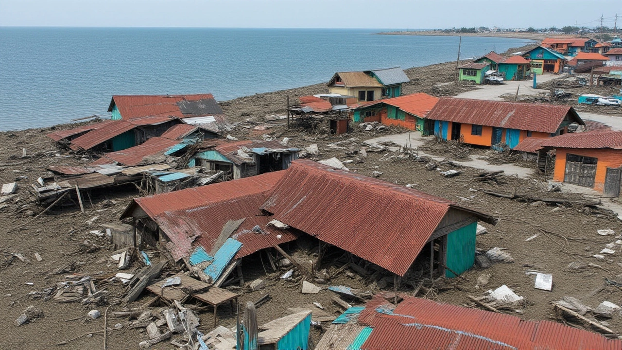
Six fatalities were confirmed by local officials, though the precise locations of the deaths have not been disclosed. Structural damage ranged from cracked walls in newly built apartments to collapsed roofs in older wooden homes. In Davao City, a four‑storey office block suffered a partial façade collapse, trapping several workers inside.
Roads and bridges crumbled under the strain. The main highway connecting Davao to Davao del Sur was blocked by debris, forcing emergency trucks to divert along secondary routes. Power outages hit at least 12 municipalities, leaving an estimated 300,000 households in the dark for up to six hours.
Internet service slowed dramatically, with mobile providers reporting a 70 % drop in bandwidth across the island. The outage hampered coordination between rescue teams, forcing many to rely on radio communications.
Response from Authorities and NGOs
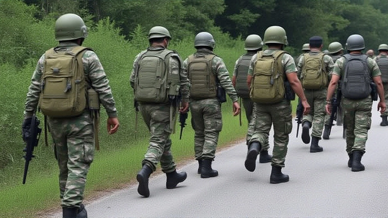
Within the first hour, the National Disaster Risk Reduction and Management Council (NDRRMC) activated its emergency operations centre in Quezon City. The council’s spokesperson, Maria Luz G. Dizon, told reporters, “Our priority is life‑saving. We have deployed 150 rescue units to the most affected barangays and are coordinating with local government units for rapid aid delivery.”
At the same time, Richard J. Gordon, Chairman and CEO of Philippine Red Cross arrived in Davao aboard a helicopter to assess the damage. In a brief interview, Gordon noted, “We’re seeing that many families have lost shelter and basic supplies. Our teams are setting up temporary shelters, distributing dry food, and providing medical triage where it’s needed most.”
The Red Cross launched a $2.3 million emergency fund, pulling resources from its nationwide network of volunteers. Local churches and NGOs also opened their doors to displaced residents, offering blankets, water, and a place to sleep.
What the Aftershocks Mean
PHIVOLCS warned that the swarm of aftershocks could continue for weeks. Each tremor, even those below magnitude 4.0, has the potential to further weaken structures already compromised by the main shock. Engineers from the University of the Philippines Mindanao are conducting rapid assessments of high‑rise buildings, looking for signs of structural fatigue.
Experts say the shallow depth of the quake—estimated at just 10 km—amplified the shaking on the surface. “A shallow quake of this size can cause damage over a wider area than a deeper one of similar magnitude,” explained Dr. Elena P. Tan, a seismologist at the Asian Institute of Technology. “The fact that it was felt across the Celebes Sea underscores its power.”
Looking Ahead: Preparedness and Recovery
In the weeks following the disaster, officials plan to conduct a comprehensive damage audit. The NDRRMC hopes to allocate ₱5 billion (about $90 million) from the national disaster fund for reconstruction of critical infrastructure, especially bridges and power lines.
Community leaders are urging residents to review evacuation plans and keep emergency kits stocked. The Philippine government has pledged to upgrade its tsunami early‑warning system, adding satellite‑based sensors to improve detection speed.
International aid is also on the table. The United Nations Office for the Coordination of Humanitarian Affairs (OCHA) has approved a modest emergency appeal, and neighboring countries like Indonesia have offered technical assistance on tsunami monitoring.
For now, the island’s resilience is being tested. As rescue crews continue to sift through rubble and families cling to what remains, the broader lesson remains clear: living on the Ring of Fire demands constant vigilance and preparedness.
Key Facts
- Magnitude: 7.4 (main shock), 6.9 (largest aftershock)
- Date & time: 10 Oct 2025, ~06:30 a.m. local
- Deaths: 6 confirmed
- Aftershocks: >300 recorded on the same day
- Areas affected: Davao City, General Santos City, Cotabato City, plus coastal villages
Frequently Asked Questions
How many people were displaced by the Mindanao earthquake?
Preliminary estimates suggest that around 18,000 residents across Davao, General Santos and surrounding barangays lost their homes or were forced to evacuate due to structural damage and power outages.
What caused the tsunami warning to be reissued after the aftershock?
The 6.9‑magnitude aftershock generated a sudden displacement of water along the eastern coast, prompting PHIVOLCS to issue a second warning as sea‑level sensors recorded a 0.2‑metre rise, enough to pose a risk to low‑lying settlements.
Which agencies are leading the rescue and relief effort?
The primary responders are the National Disaster Risk Reduction and Management Council (NDRRMC), the Philippine Institute of Volcanology and Seismology (PHIVOLCS), and the Philippine Red Cross, supported by local government units, the Armed Forces, and international NGOs.
Will the aftershocks affect reconstruction plans?
Yes. Engineers are delaying the clearance of heavily damaged buildings until the aftershock sequence stabilises, which could push back reconstruction timelines by several months.
How does this earthquake compare to previous major quakes in the Philippines?
At magnitude 7.4, it is the strongest recorded in the Philippines for 2025 and rivals the 7.2‑magnitude 2013 Bohol quake, which caused over 220 deaths. However, the shallow depth of the Mindanao event amplified surface shaking, leading to more widespread structural damage despite a lower death toll so far.